In summary:
- Effective night safety in DTLA isn’t about avoiding “bad” areas, but learning to read the urban environment’s subtle cues.
- Focus on “natural surveillance”—areas with active storefronts, residential balconies, and pedestrian flow create their own safety.
- Master the “Confident Stride”: walk with purpose, scan your environment ahead, and project local awareness to deter unwanted attention.
- Use “islands of activity” like 24-hour diners, busy hotel entrances, and event venues as strategic anchor points for your route.
- Understand that safety levels can change abruptly from one block to the next; assess these “transition zones” before crossing.
The thought of walking through a major American city’s downtown core after dark can be daunting, especially for a solo traveler. Downtown Los Angeles, with its stark contrasts and sprawling layout, is a prime example. You’ve probably heard the standard advice: stick to well-lit streets, don’t flash valuables, be aware of your surroundings. While not wrong, this advice is generic and fails to empower you. It treats the city as a monolithic threat to be avoided, rather than a complex environment to be understood and navigated.
The reality is far more nuanced. Safety in a high-contrast city like LA isn’t a static map of “good” and “bad” zones. It’s a dynamic, fluid condition that changes block by block, hour by hour. But what if the key to safety wasn’t just avoidance, but active perception? What if you could learn to read the subtle signals of the street—the presence of “eyes on the street,” the hum of commercial activity, the body language of fellow pedestrians—to create your own safe corridors, even at night? This is the core principle of street-smart urban navigation.
This guide moves beyond the platitudes. We will use Downtown LA as our primary case study to teach you this framework of active perception. We will then broaden our scope to explore related skills—from projecting confidence in a crowded subway to using micro-mobility strategically—that are essential for any savvy urban explorer. By understanding these principles, you’ll gain the confidence to not just survive, but truly experience the vibrant heart of the city after sunset.
This article breaks down the essential strategies for confident urban exploration. From deciphering neighborhood dynamics to mastering your own presence, each section provides a piece of the puzzle for navigating any major city with intelligence and assurance.
Summary: A Street-Smart Guide to Navigating Downtown Los Angeles Safely at Night
- Why Crossing One Street Can Change the Safety Level of a US Neighborhood?
- How to Navigate the NYC Subway System Without Looking Like a Tourist?
- Times Square vs. Hell’s Kitchen: Where to Eat for Half the Price and Double the Flavor?
- The Airbnb Scam That Targets Weekend Travelers in Major US Cities
- When to Visit Major Museums to Avoid the 2-Hour Weekend Lines?
- Train vs. Plane vs. Car: What is the Best Option for the Northeast Corridor?
- LinkedIn or Local Mixers: Which Yields Better Leads for Consultants?
- How to Attend Coachella or Burning Man on a ‘Normal Person’ Budget?
Why Crossing One Street Can Change the Safety Level of a US Neighborhood?
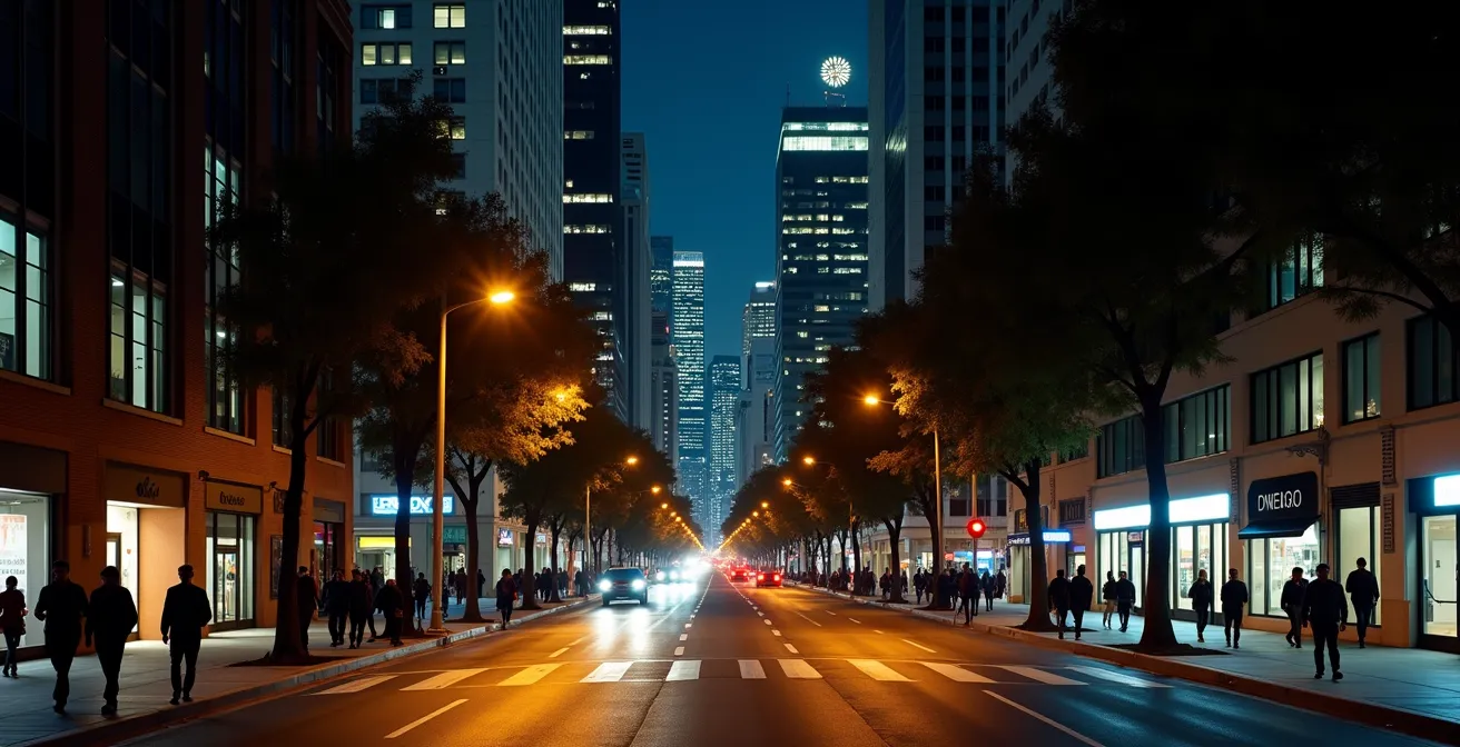
The single most important concept for urban night safety is understanding street-level topography. In cities like Los Angeles, historical development, zoning laws, and economic drivers have created sharp, often invisible, borders between districts. You can be in the brightly lit, heavily secured Financial District one moment, and by crossing a single intersection, find yourself in an area with dramatically less foot traffic and fewer active businesses, like Skid Row. This abrupt shift is why blanket advice often fails. The high-contrast nature of DTLA is a reality reflected in statistics showing a crime rate of 135.9 per 1,000 residents in some areas, a figure that varies wildly by block.
The key isn’t memorizing a map of “no-go” zones, which can be outdated, but learning to assess the environment in real-time. The legendary urbanist Jane Jacobs championed the idea of “natural surveillance,” a principle that remains the gold standard for urban safety. As she articulated in her seminal work, “The Death and Life of Great American Cities”:
There must be eyes upon the street, eyes belonging to those we might call the natural proprietors of the street.
– Jane Jacobs, The Death and Life of Great American Cities
These “eyes” belong to residents on their balconies, patrons in cafes, shopkeepers, and other pedestrians. An empty street with shuttered storefronts, even if well-lit, lacks this fundamental layer of community-based security. Areas with a healthy mix of residential and late-night commercial activity, like Bunker Hill or parts of the Arts District, inherently have more natural surveillance. Your primary skill is to learn to spot its presence or absence instantly.
How to Navigate the NYC Subway System Without Looking Like a Tourist?
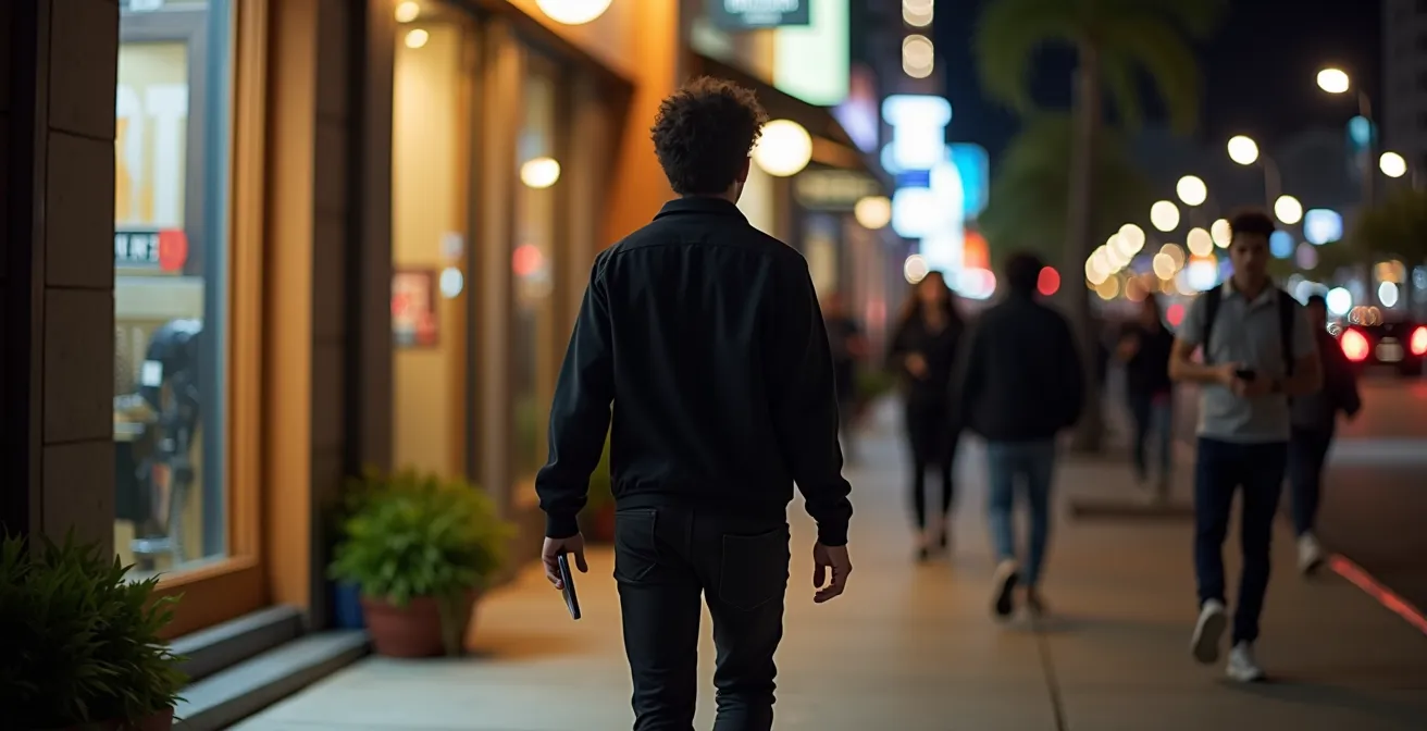
While this question is about New York, the underlying principle is universal and critical for walking in DTLA: projecting confidence and local awareness. Opportunistic individuals are not looking for a challenge; they are scanning for easy targets. A person who looks lost, hesitant, or engrossed in their phone screen signals vulnerability. Conversely, someone moving with purpose and demonstrating situational awareness is a much less attractive target. This isn’t about being aggressive; it’s about inhabiting the space with quiet authority.
The physical manifestation of this is the “Confident Stride.” It’s a technique that involves more than just walking quickly. It’s about your entire posture and focus. This approach is not just theoretical; it’s a practical tool for urban navigation.
Case Study: The DTLA Confident Stride Technique
As detailed by seasoned urban explorers, the “Confident Stride” is a key deterrent. It involves maintaining a consistent pace, scanning the path 30 feet ahead instead of looking down at your feet, and walking with a clear destination in mind (even if you’re just exploring). This posture—head up, shoulders back, phone at your side rather than in front of your face—signals that you are alert, familiar with your surroundings, and not easily distracted. It changes how you are perceived and dramatically reduces the likelihood of being approached.
To cultivate this, plan your route *before* you leave. Know your general direction so you’re not constantly stopping to check your map. The goal is to move like a local commuter, not a bewildered tourist. This projection of confidence is your first and most effective layer of personal security.
As you can see, confident body language sends a powerful, non-verbal message. By walking with your head up and scanning your environment, you are not only safer but also more engaged with the city around you, turning a potentially stressful walk into an empowering experience of urban exploration.
Times Square vs. Hell’s Kitchen: Where to Eat for Half the Price and Double the Flavor?
This classic New York dilemma holds a vital lesson for navigating DTLA at night. The choice isn’t just about food or price; it’s about understanding how commercial activity creates safety. Times Square, like L.A. Live, is an obvious hub of activity. It’s bright, crowded, and heavily secured—a clear “island of activity.” Hell’s Kitchen, like many smaller DTLA neighborhoods such as South Park, offers a different texture of safety: more local, less tourist-dense, but still populated with active restaurants and bars that provide natural surveillance.
Your strategy for a nighttime walk should involve stringing these islands of activity together. A 24-hour diner, a cluster of popular food trucks, or the entrance to a bustling hotel are not just landmarks; they are strategic anchors. Before you set out, identify a few of these along your potential route. They become safe havens and points of re-evaluation. If a street feels too quiet or deserted, your next objective is simply to get to the next island of light and people.
This table compares two distinct DTLA zones, illustrating how different types of commercial activity create different safety dynamics, much like the Times Square vs. Hell’s Kitchen contrast.
| Aspect | L.A. Live | South Park |
|---|---|---|
| Price Range | $$$$ | $$ |
| Safety Level | Very High (security presence) | Moderate (residential area) |
| Peak Hours | Event-driven (concerts, games) | Regular dinner hours |
| Crowd Type | Tourists, event-goers | Locals, USC students |
| Late Night Options | Multiple until 2 AM | Limited after 10 PM |
Both options offer relative safety, but for different reasons. L.A. Live relies on formal security and event crowds, while South Park relies on the natural surveillance of a populated residential and dining area. Understanding this allows you to choose your environment based on the time of night and your comfort level.
The Airbnb Scam That Targets Weekend Travelers in Major US Cities
While the specifics of a scam are one concern, the broader lesson for a solo walker is how to manage and disengage from any unwanted street interaction. Whether it’s an aggressive solicitor, someone asking for money, or a potential scammer, your response should be practiced and automatic. The goal is polite, firm disengagement—not confrontation. Every second you are stopped and engaged is a moment of increased vulnerability. Your momentum is your shield.
It’s important to maintain perspective. The vast majority of people you encounter have no ill intent. In fact, a study by Longwood Travel USA revealed that nearly 96% of visitors to Los Angeles felt safe during their trip. This indicates that while vigilance is smart, paranoia is unnecessary. The key is having a pre-planned script for the rare uncomfortable encounter so you don’t have to invent a response under pressure. This script is often non-verbal.
Here are some field-tested strategies for gracefully exiting an unwanted conversation while maintaining your safety bubble:
- Keep Walking: Never stop. If someone tries to engage you, you can offer a firm “No, thank you” or a simple headshake while maintaining your pace. Your forward motion is the clearest signal that you are not stopping.
- Avoid Eye Contact: With aggressive individuals, direct eye contact can be misinterpreted as an invitation to engage or a challenge. It’s better to keep your gaze focused ahead on your path.
- Secure Your Valuables: Proactively manage your belongings in crowded or transitional areas. Keep your wallet in a front pocket and hold your purse or bag firmly and in front of you.
- Move Toward Population: If you feel threatened or cornered, don’t just stand there. Immediately change your path and move directly toward the nearest “island of activity”—a lighted storefront, a group of people, or a hotel entrance.
- Have a Safe Destination: Always have a “mental safe point” in mind, such as your hotel’s 24/7 lobby. Knowing you have a definite sanctuary to head towards can provide direction and purpose under stress.
When to Visit Major Museums to Avoid the 2-Hour Weekend Lines?
The logic used to avoid museum crowds can be inverted to enhance your safety at night. While you visit a museum during off-peak hours to avoid people, for a nighttime walk, you want to leverage peak hours and crowds to your advantage. A street filled with people leaving a concert or basketball game at L.A. Live is one of the safest environments you can be in. The sheer volume of pedestrians creates a massive field of natural surveillance.
This means timing is a strategic tool. A street that is deserted and potentially unsafe at 1 AM might be perfectly safe at 10 PM when restaurants are letting out. The “Golden Hours” of nightlife are your friend. This is the period when the city is most alive with legitimate activity.
Field Note: The Golden Hours of DTLA Nightlife
Local guides and safety experts note that the period between 8 PM and 11 PM is often the sweet spot for nightlife in districts like the Arts District or around L.A. Live. During these hours, restaurants, bars, and venues are at their busiest, ensuring that streets are well-populated and monitored by both patrons and security. Planning your walk to coincide with these “Golden Hours” means you are moving with the natural, positive flow of the city, rather than against it.
Instead of seeing crowds as an obstacle, view them as a temporary safety asset. Check the schedules for venues like the Crypto.com Arena or the Microsoft Theater. Planning your walk to begin or end as an event lets out is a high-level strategy for ensuring a safe and vibrant passage through what might otherwise be quiet streets.
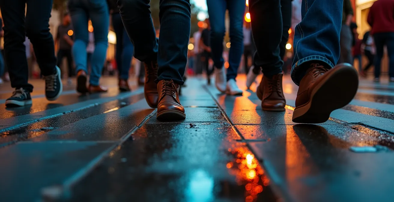
The texture of a crowd provides a powerful safety net. The movement, the ambient noise, and the sheer number of people create an environment where anonymity works in your favor, as you become just one part of a larger, dynamic flow.
Train vs. Plane vs. Car: What is the Best Option for the Northeast Corridor?
While this question concerns long-distance travel, the strategic thinking behind it applies directly to how you move *within* Downtown LA at night. You wouldn’t walk across a “dead zone”—a long stretch of street with no open businesses or residences—just as you wouldn’t choose the wrong mode of transport for a long trip. For the urban explorer, the choice is between walking, using a rideshare, or hopping on a metro bike or scooter. Each has its place in a smart micro-mobility strategy.
Walking is ideal for short hops between vibrant, adjacent blocks where natural surveillance is high. It’s free and allows you to fully experience the city. However, when faced with a “transition zone” or a multi-block stretch of quiet warehouses or office buildings that are closed for the night, walking is the highest-risk option. This is where you must be willing to switch modes.
Rideshare services are your tool for “bridging” these dead zones. Spending $10 on a five-minute ride to cross a half-mile of deserted street is not a failure; it’s a brilliant safety investment. It’s the equivalent of choosing a plane over a car for a cross-country trip. It’s about using the right tool for the job. This table breaks down your options for navigating DTLA’s complex grid at night.
| Transport Mode | Best For | Safety Rating | Cost |
|---|---|---|---|
| Walking | Short hops between safe zones | Moderate (depends on area) | Free |
| Metro Bike/Scooter | Medium distances on protected lanes | Moderate | $1-5 |
| Rideshare | Crossing dead zones, final trip home after midnight | High | $8-15 |
| Metro Rail | Long distances during operating hours | Moderate (avoid late night) | $1.75 |
The savvy traveler doesn’t stick to one mode. They are a “hybrid-commuter,” seamlessly switching between walking and rideshare based on a constant assessment of the street-level topography. The goal is not to be a pedestrian hero, but to be a safe and smart navigator.
LinkedIn or Local Mixers: Which Yields Better Leads for Consultants?
The hidden lesson in this business question is the value of on-the-ground intelligence versus remote analysis. For a consultant, a local mixer provides texture and nuance that LinkedIn cannot. For the urban traveler, this translates to the skill of reading a street’s profile in person. No crime map or online guide can fully replace your own sensory assessment of a block. You must become adept at quickly diagnosing the health and safety of a street by looking for key indicators.
This process is an active audit. You are looking for signs of a vibrant, mixed-use community. Are there residential buildings with lights on and balconies? Are there late-night businesses like restaurants or small grocery stores? Are there safety teams from a Business Improvement District (BID), often identifiable by their colored jackets, providing a formal layer of security? The presence of these elements indicates a street with a vested community and a higher degree of safety.
Conversely, you must also learn to spot the red flags of a “transition zone,” the area where a safe neighborhood abuts a more problematic one. These zones are often where opportunistic crime is highest. You can’t rely on a map alone; you must develop a feel for when the character of the city is about to shift. This active assessment is the ultimate street-smart skill.
Action Plan: Auditing a Street’s Safety Profile
- Assess Geographic Disparities: Be aware that crime rates are not uniform. Before you go, check a resource that highlights major variances. For example, some sources show that Downtown and Skid Row can have triple the overall crime rate of adjacent, well-populated commercial areas. This gives you a baseline for what to expect.
- Identify Positive Indicators: As you walk, actively look for signs of a healthy street life. This includes well-maintained storefronts, outdoor dining patios, active residential balconies, and consistent pedestrian flow. These are the “eyes on the street.”
- Check for Formal Security: Look for the presence of Business Improvement District (BID) safety teams. In DTLA, they often wear bright purple or yellow jackets and patrol on foot or bicycle. Their presence is a strong indicator of a managed and monitored environment.
- Note the Transition Zones: Pay close attention when moving between named districts (e.g., from the Financial District towards the Historic Core). Notice changes in building maintenance, lighting quality, and the number of shuttered businesses. A sudden drop-off in “street life” is your cue to heighten awareness or consider a different route.
- Evaluate Time of Day: Re-assess the street’s profile based on the hour. A block that is bustling and safe at 8 PM due to restaurants can become deserted and risky by midnight. Your safety audit is not a one-time check but a continuous process.
Key Takeaways
- Your most powerful safety tool is not an app, but your own informed perception. Learn to read the environment.
- Safety is dynamic, not static. A street’s safety level depends on time of day, commercial activity, and pedestrian flow.
- Projecting confidence through body language—the “Confident Stride”—is a primary deterrent to unwanted attention.
Putting It All Together: Your Urban Safety Framework
Just as one might budget for a major event like Coachella, you must budget your resources—attention, energy, and tools—for a night out in the city. The strategies we’ve discussed are not isolated tricks; they form a cohesive framework for urban survival and exploration. This framework relies on a combination of pre-planning, in-the-moment assessment, and having the right low-cost tools on hand. It’s not about being burdened with gear; it’s about having a few key items that act as force multipliers for your safety.
Your personal “urban survival kit” should be lightweight and practical. Think of it as insurance. You hope you don’t need it, but you’re prepared if you do. The most critical component is a fully charged phone with a portable power bank, as navigation and communication are your lifelines. But other simple items can provide a significant psychological and practical edge. Having offline maps downloaded (for when cell service fails in urban canyons), a loud personal alarm, and carrying your cash and cards in a concealed money belt can free up your mental energy to focus on what matters most: observing your surroundings.
Finally, remember to leverage the free safety assets the city provides. BID Safety Teams are paid to be a resource; don’t hesitate to ask them for directions or an escort if you feel uncomfortable. Hotel lobbies, 24-hour pharmacies, and even fire stations are recognized safe havens you can duck into if you need a moment to regroup. By combining your personal preparedness with these public resources, you create multiple layers of security.
Your ability to explore Downtown Los Angeles—or any major city—safely and confidently at night is now in your hands. It’s a skill built not on fear, but on knowledge. Start putting this framework into practice by consciously reading the street, identifying your islands of activity, and walking with purpose. Transform your next urban adventure from an exercise in anxiety to an act of empowered exploration.